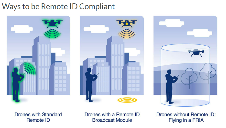
-
Hot Cars & LiPo Batteries: A Swell Mix or an Epic Fail?
LiPo batteries, also known as lithium polymer batteries, are a…
-

Why the House’s DJI Ban Under NDAA Was No Surprise to The LiDAR PROs Team
The recent Senate vote to ban DJI in the NDAA bill may…
-
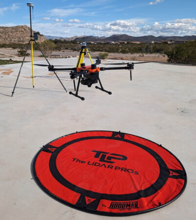
RTK and Drone Mapping: Do You Need It? Is It Worth It?
Real-Time Kinematic (RTK) is a buzz term in the UA…
-
-
-
-
-
Is Information Security (INFOSEC) Important to Your UAS Program? (it should be)
June, 2018 Last week I gave a seminar on various…
-
-
Western Regional Survey Conference 3/23-25 2024
Today started the Western Regional Survey Conference where our team…